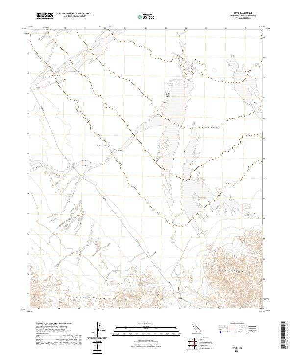
2021 Map of Styx
USGS Topo · Published 2021About this map
Styx sits as a lonely marker in the arid expanse of eastern Riverside County, where the desert landscape is defined by the shifting sands and dramatic relief of the Big Maria Mountains and the Little Maria Mountains. This modern topographic study reveals a terrain of vast alluvial washes and dramatic drainage patterns radiating from the mountain slopes into Rice Valley. The dominance of Midland Rd provides the primary north-south artery through this sparsely settled region, tracing a path through the valley floor. The map highlights the intersection of township and range boundaries, such as t2s r20e, illustrating the rigid grid of the Public Land Survey System as it overlays the irregular, naturally occurring features of the California desert. Researchers will find a clear record of the area's hydrology and topography, capturing the remote character of the desert floor before any further modern development.
Find a feature on this map
9 named features on this map. Tap any name to fly to it.
Don’t see what you’re looking for? This feature index may not catch every label — zoom into the map to look around manually.
Map Details
Editions of this 2021 Styx Map
This is the sole edition of this map. No revisions or reprints were ever made.
Other maps of this area

1942 · Blythe
USGS Topo · 1:250,000

1943 · Vidal
USGS Topo · 1:62,500

1945 · Big Maria Mtns
USGS Topo · 1:62,500

1945 · Midland
USGS Topo · 1:62,500

1949 · Vidal
USGS Topo · 1:62,500

1950 · Vidal
USGS Topo · 1:62,500

1951 · Big Maria Mts
USGS Topo · 1:62,500

1952 · Midland
USGS Topo · 1:62,500

1954 · Salton Sea
USGS Topo · 1:250,000

1954 · Needles
USGS Topo · 1:250,000