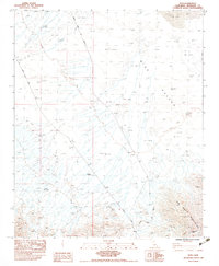
1983 Map of Styx
USGS Topo · Published 1983About this map
The Big Maria Mountains dominate the southeastern corner of this arid landscape, where the Atchison Topeka and Santa Fe railroad line skirts the foothills. This 1983 survey captures a region defined by industrial extraction and logistical transit through the desert, centered on the small settlement of Styx. The topographic detail reveals a complex network of drainage through Dry Wash features and shifting Sand Dunes that characterize Rice Valley.
Find a feature on this map
12 named features on this map. Tap any name to fly to it.
Don’t see what you’re looking for? This feature index may not catch every label — zoom into the map to look around manually.
Map Details
Editions of this 1983 Styx Map
This is the sole edition of this map. No revisions or reprints were ever made.
Other maps of this area

1942 · Blythe
USGS Topo · 1:250,000

1943 · Vidal
USGS Topo · 1:62,500

1945 · Big Maria Mtns
USGS Topo · 1:62,500

1945 · Midland
USGS Topo · 1:62,500

1949 · Vidal
USGS Topo · 1:62,500

1950 · Vidal
USGS Topo · 1:62,500

1951 · Big Maria Mts
USGS Topo · 1:62,500

1952 · Midland
USGS Topo · 1:62,500

1954 · Salton Sea
USGS Topo · 1:250,000

1954 · Needles
USGS Topo · 1:250,000