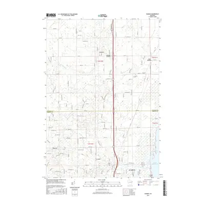
2016 Map of Suamico
USGS Topo · Published 2016About this map
Suamico and the surrounding shoreline of Green Bay define the character of this coastal Wisconsin landscape. The map highlights a series of small, established communities including Sobieski, Flintville, and Tremble, which are connected by a network of rural roads that straddle the Oconto Co and Brown Co line. Significant natural drainage systems, such as the Suamico River and Little Suamico River, flow toward the waters of Lake Michigan, while the Long Tail Point landform marks the eastern aquatic boundary.
Find a feature on this map
56 named features on this map. Tap any name to fly to it.
Don’t see what you’re looking for? This feature index may not catch every label — zoom into the map to look around manually.
Map Details
Editions of this 2016 Suamico Map
This is the sole edition of this map. No revisions or reprints were ever made.
Other maps of this area

1954 · Green Bay West
USGS Topo · 1:24,000

1954 · New Franken
USGS Topo · 1:62,500

1954 · Green Bay East
USGS Topo · 1:24,000

1954 · Manitowoc
USGS Topo · 1:250,000

1954 · Green Bay
USGS Topo · 1:62,500

1955 · Green Bay
USGS Topo · 1:250,000

1956 · Oconto
USGS Topo · 1:62,500

1956 · Oconto Falls
USGS Topo · 1:62,500

1958 · Manitowoc
USGS Topo · 1:250,000

1974 · Abrams
USGS Topo · 1:24,000