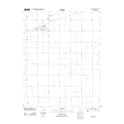
2012 Map of Sublette
USGS Topo · Published 2012About this map
Sublette serves as the central hub for this Haskell County landscape, characterized by the rigid grid of the High Plains and a transportation network oriented around agricultural commerce. The town layout is detailed with specific thoroughfares like Watkins Ave, Edelle Ave, and Diaden Dr, surrounding the local Po. Public and community spaces are concentrated on the northern edge of the settlement, including the Haskell County Fairgrounds and the Sublette Flying Club Airport. Outside the town center, the terrain is dominated by a systematic series of county roads, such as Co Road NN and Co Road SS, and the industrial presence of the Co Road Railroad, which underscores the region's reliance on rail for moving Kansas grain and resources.
Find a feature on this map
39 named features on this map. Tap any name to fly to it.
Don’t see what you’re looking for? This feature index may not catch every label — zoom into the map to look around manually.
Map Details
Editions of this 2012 Sublette Map
This is the sole edition of this map. No revisions or reprints were ever made.
Other maps of this area

1896 · Garden
USGS Topo · 1:125,000

1955 · Dodge City
USGS Topo · 1:250,000

1958 · Dodge City
USGS Topo · 1:250,000

1959 · Dodge City
USGS Topo · 1:250,000

1960 · Garden City 3 SW
USGS Topo · 1:24,000

1960 · Garden City 3 SE
USGS Topo · 1:24,000

1968 · Plains SW
USGS Topo · 1:24,000

1968 · Sublette SW
USGS Topo · 1:24,000

1968 · Plains NW
USGS Topo · 1:24,000
1968 · Satanta
USGS Topo · 1:24,000