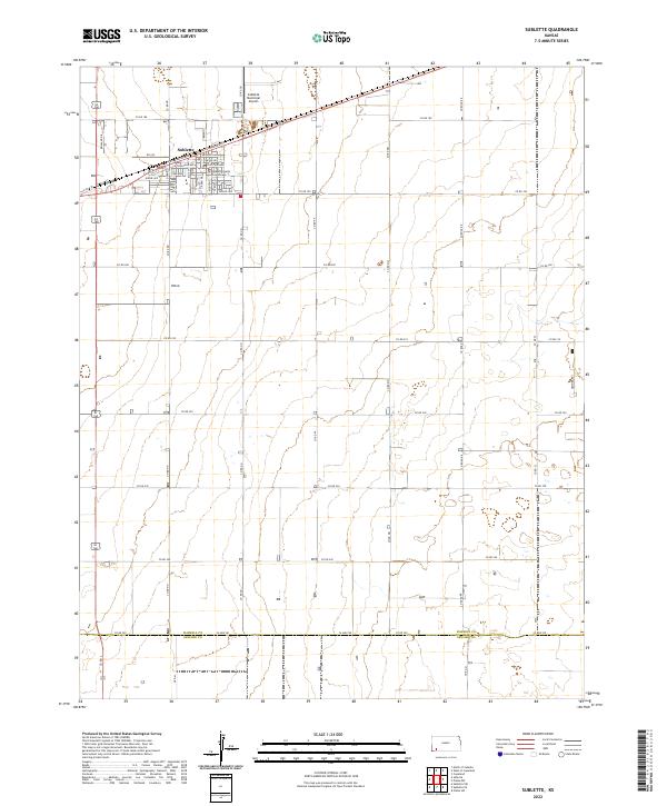
2022 Map of Sublette
USGS Topo · Published 2022About this map
Sublette serves as the seat of Haskell Co, organized around a strict grid of residential and municipal landmarks. The town center is anchored by the Haskell County Courthouse, with street names such as Becknell Ave, E Chouteau Ave, and Jennie Ave defining the local geography. To the north, the Sublette Municipal Airport provides a key point of infrastructure along the diagonal path of US Highway 160. The surrounding High Plains landscape is marked by the transition to Seward Co at the southern edge, where 24 Mile Rd traces the county boundary. This environment is characterized by a series of sections and township lines, including t29s r32w and t30s r32w, reflecting the systematic agricultural development of western Kansas. Local roads like Reinland Dr and Co Rd NN form the framework for this vast rural expanse.
Find a feature on this map
47 named features on this map. Tap any name to fly to it.
Don’t see what you’re looking for? This feature index may not catch every label — zoom into the map to look around manually.
Map Details
Editions of this 2022 Sublette Map
This is the sole edition of this map. No revisions or reprints were ever made.
Other maps of this area

1896 · Garden
USGS Topo · 1:125,000

1955 · Dodge City
USGS Topo · 1:250,000

1958 · Dodge City
USGS Topo · 1:250,000

1959 · Dodge City
USGS Topo · 1:250,000

1960 · Garden City 3 SW
USGS Topo · 1:24,000

1960 · Garden City 3 SE
USGS Topo · 1:24,000

1968 · Plains SW
USGS Topo · 1:24,000

1968 · Sublette SW
USGS Topo · 1:24,000

1968 · Plains NW
USGS Topo · 1:24,000
1968 · Satanta
USGS Topo · 1:24,000