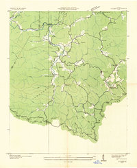
1935 Map of Suches
USGS Topo · Published 1935About this map
Cherokee National Forest land dominates this high-altitude 1935 survey, illustrating a mountain landscape transitioning under federal management. Local industry is clearly marked by several family-run operations including Gilreath Mill, Gooch Mill, and Cochran Mill, while the presence of CCC Camp F1 and a CCC Quarry near Suches highlights the era’s labor relief programs and infrastructure building. Small rural communities and isolated homesites like Baxter, Gaddistown, and Headtown are connected by primitive roads and mountain gaps.
Find a feature on this map
76 named features on this map. Tap any name to fly to it.
Don’t see what you’re looking for? This feature index may not catch every label — zoom into the map to look around manually.
Map Details
Editions of this 1935 Suches Map
This is the sole edition of this map. No revisions or reprints were ever made.
Other maps of this area

1886 · Dahlonega
USGS Topo · 1:125,000

1888 · Ellijay
USGS Topo · 1:125,000

1892 · Dahlonega
USGS Topo · 1:125,000

1892 · Ellijay
USGS Topo · 1:125,000

1896 · Dahlonega
USGS Topo · 1:125,000

1898 · Ellijay
USGS Topo · 1:125,000

1903 · Dahlonega
USGS Topo · 1:125,000

1911 · Ellijay
USGS Topo · 1:125,000

1935 · Coosa Bald
USGS Topo · 1:24,000

1935 · Mulky Gap
USGS Topo · 1:24,000