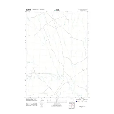
2012 Map of Sucker Dam
USGS Topo · Published 2012About this map
Rosette Geyser and a complex network of seasonal drainage channels define this high-plains landscape in Washakie County. The terrain is deeply inscribed by water courses like Dry Cottonwood Cr, Corral Cr, and Reservoir Cr, which all move toward the southern drainage of Fifteenmile Cr. The primary industrial and transit markers are sparse but significant, consisting of the Platte Pipeline Rd and 15 Mile Rd. This 2012 survey illustrates the typical Wyoming basin topography where water, even in dry creek beds, dictates the local geography. The presence of a named geothermal feature, the Rosette Geyser, provides a unique geological point of interest amidst the branching tributaries of N Fork Fifteenmile Cr and Rock Waterhole Cr.
Find a feature on this map
10 named features on this map. Tap any name to fly to it.
Don’t see what you’re looking for? This feature index may not catch every label — zoom into the map to look around manually.
Map Details
Editions of this 2012 Sucker Dam Map
This is the sole edition of this map. No revisions or reprints were ever made.
Other maps of this area

1951 · Sucker Dam
USGS Topo · 1:24,000

1951 · Dutch Nick Flat
USGS Topo · 1:24,000

1951 · Schuster Flats
USGS Topo · 1:24,000

1951 · Schuster Flats NW
USGS Topo · 1:24,000

1951 · Dutch Nick Flat SW
USGS Topo · 1:24,000

1951 · Sheep Mountain
USGS Topo · 1:24,000

1951 · Wardel Reservoir
USGS Topo · 1:24,000

1951 · Dutch Nick Flat NW
USGS Topo · 1:24,000

1955 · Cody
USGS Topo · 1:250,000

1958 · Cody
USGS Topo · 1:250,000