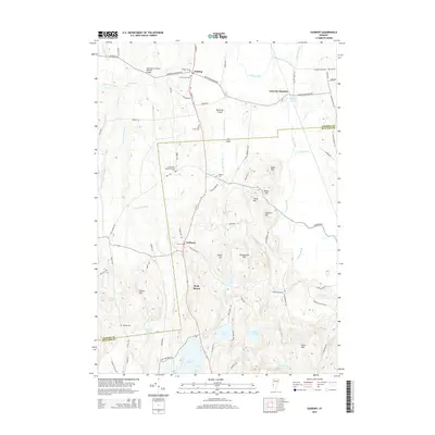
2015 Map of Sudbury
USGS Topo · Published 2015About this map
Hyde Manor and the surrounding township of Sudbury anchor this landscape, where the northern reaches of Lake Hortonia meet the high ground of Felton Hill and Signal Hill. This area is defined by its numerous small ponds and the drainage patterns of the Lemon Fair River and Otter Creek. The map documents a high density of small family and community burial grounds, including the Old South Cem and the Crown Point Road Monument Cem, indicating deep historical roots in this part of Vermont. To the north, the crossing at Leicester Junction and the presence of the Shoreham Covered Railroad Bridge reflect the importance of transportation infrastructure in connecting these rural agricultural communities. The terrain transitions from the low-lying Swamp Pond near the Leicester River to the prominent heights of Stiles Mtn in the south.
Find a feature on this map
84 named features on this map. Tap any name to fly to it.
Don’t see what you’re looking for? This feature index may not catch every label — zoom into the map to look around manually.
Map Details
Editions of this 2015 Sudbury Map
This is the sole edition of this map. No revisions or reprints were ever made.
Other maps of this area

1893 · Whitehall
USGS Topo · 1:62,500

1894 · Ticonderoga
USGS Topo · 1:62,500

1895 · Whitehall
USGS Topo · 1:62,500

1895 · Castleton
USGS Topo · 1:62,500

1896 · Ticonderoga
USGS Topo · 1:62,500

1897 · Castleton
USGS Topo · 1:62,500

1898 · Whitehall
USGS Topo · 1:62,500

1902 · Whitehall
USGS Topo · 1:62,500

1902 · Ticonderoga
USGS Topo · 1:62,500

1902 · Brandon
USGS Topo · 1:62,500