2024 Map of Sugar Grove
USGS Topo · Published 2024About this map
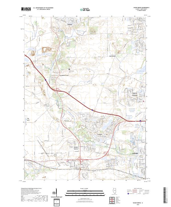
Sugar Grove and the surrounding Kane County landscape appear here in a modern era of suburban expansion and integrated transportation. The map reveals a complex web of modern subdivisions like Prestbury and Nottingham Woods interspersed with vital regional infrastructure, including the Aurora Municipal Airport and the campus of Waubonsee Community College. These contemporary developments are anchored by much older landmarks, such as the Sugar Grove Cem and Lance-Saunders Family Cem, which offer physical links to the area's early pioneer history.
Find a feature on this map
187 named features on this map. Tap any name to fly to it.
Don’t see what you’re looking for? This feature index may not catch every label — zoom into the map to look around manually.
Map Details
Editions of this 2024 Sugar Grove Map
This is the sole edition of this map. No revisions or reprints were ever made.
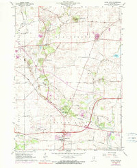
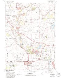
Historical Maps of Batavia Township Through Time
3 maps found
Featured Locations
- Aurora, IL
- North Aurora, IL
- Sugar Grove, Sugar Grove Township
- Big Rock, Big Rock Township
- Elburn, Blackberry Township