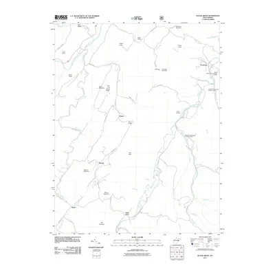
2011 Map of Sugar Grove
USGS Topo · Published 2011About this map
Sugar Grove and the surrounding mountain settlements of the South Branch Potomac River valley are detailed in this survey of Pendleton County. The landscape is defined by the sharp ridges of the Appalachians, including Mitchell Mountain and Hoover Mountain, which frame a network of small communities and family-named landmarks. The area's water management is visible through a series of significant flood control structures, specifically South Fork Structure Number 15 Dam, Number 16, and South Fork Structure Number 17 Dam. These modern engineering features sit alongside older geographic markers like Mill Gap and Raven Rocks. Settlement patterns follow the river and its many tributaries, such as Thorn Creek and Stauffles Run, connecting small hamlets like Dahmer, Mitchell, and Propstburg. The map illustrates the persistent rural character of this region, where winding routes like County HWY-220 and Dahmer RD link isolated valleys and high knobs.
Find a feature on this map
65 named features on this map. Tap any name to fly to it.
Don’t see what you’re looking for? This feature index may not catch every label — zoom into the map to look around manually.
Map Details
Editions of this 2011 Sugar Grove Map
This is the sole edition of this map. No revisions or reprints were ever made.
Other maps of this area

1892 · Franklin
USGS Topo · 1:125,000

1894 · Staunton
USGS Topo · 1:125,000

1896 · Franklin
USGS Topo · 1:125,000

1922 · Fort Seybert
USGS Topo · 1:48,000

1922 · Circleville
USGS Topo · 1:62,500

1924 · Circleville
USGS Topo · 1:48,000

1924 · Mc Dowell
USGS Topo · 1:62,500

1924 · Fort Seybert
USGS Topo · 1:62,500

1944 · Parnassus
USGS Topo · 1:62,500

1944 · Mc Dowell
USGS Topo · 1:62,500