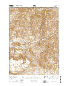
2014 Map of Sugarloaf Butte
USGS Topo · Published 2014About this map
Sugarloaf Butte and Houston Butte rise above the high-desert landscape of central Oregon in this 2014 topographic study. This section of Crook County is defined by a series of distinct drainage systems and geological formations, where Bear Cr and Spring Cr carve through the arid terrain. The map captures the complex topography of Juniper Canyon and Norman Canyon as they descend toward the basin, while the southern reaches are dominated by the elevation of South Fork Hill and the prominent Rodman Rim. Access is largely limited to unpaved tracks and the winding SE Roberts Rd, illustrating the rural, open character of the region. Survey lines for t18s r18e and t19s r18e provide the structural framework for this transition zone between buttes and deep canyon washes.
Find a feature on this map
14 named features on this map. Tap any name to fly to it.
Don’t see what you’re looking for? This feature index may not catch every label — zoom into the map to look around manually.
Map Details
Editions of this 2014 Sugarloaf Butte Map
This is the sole edition of this map. No revisions or reprints were ever made.
Other maps of this area

1946 · Eagle Rock
USGS Topo · 1:62,500

1948 · Eagle Rock
USGS Topo · 1:62,500

1951 · Post
USGS Topo · 1:62,500

1955 · Crescent
USGS Topo · 1:250,000

1955 · Bend
USGS Topo · 1:250,000

1957 · Crescent
USGS Topo · 1:250,000

1957 · Bend
USGS Topo · 1:250,000

1958 · Crescent
USGS Topo · 1:250,000

1958 · Bend
USGS Topo · 1:250,000

1967 · Brothers NW
USGS Topo · 1:24,000