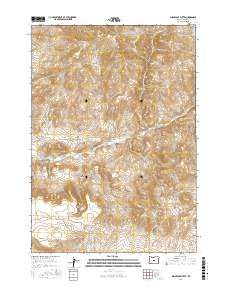
2017 Map of Sugarloaf Butte
USGS Topo · Published 2017About this map
Sugarloaf Butte and Houston Butte rise as prominent landmarks in this high-desert portion of Crook County, where the volcanic geology of Central Oregon is clearly defined by distinct rimrocks and drainage patterns. The landscape is carved by a network of seasonal watercourses, most notably Bear Cr, which is followed by the primary transit route of Bear Creek Rd as it moves through the heart of the quadrangle. High-elevation features like Million Hill and the long stretch of Rodman Rim overlook deep cuts in the terrain such as Juniper Canyon and Norman Canyon. This survey captures the sparse infrastructure of the region, defined by remote ranch roads and the Public Land Survey System boundaries of t18s r18e and t19s r18e, illustrating a territory where topography dictates the few avenues of human movement.
Find a feature on this map
17 named features on this map. Tap any name to fly to it.
Don’t see what you’re looking for? This feature index may not catch every label — zoom into the map to look around manually.
Map Details
Editions of this 2017 Sugarloaf Butte Map
This is the sole edition of this map. No revisions or reprints were ever made.
Other maps of this area

1946 · Eagle Rock
USGS Topo · 1:62,500

1948 · Eagle Rock
USGS Topo · 1:62,500

1951 · Post
USGS Topo · 1:62,500

1955 · Crescent
USGS Topo · 1:250,000

1955 · Bend
USGS Topo · 1:250,000

1957 · Crescent
USGS Topo · 1:250,000

1957 · Bend
USGS Topo · 1:250,000

1958 · Crescent
USGS Topo · 1:250,000

1958 · Bend
USGS Topo · 1:250,000

1967 · Brothers NW
USGS Topo · 1:24,000