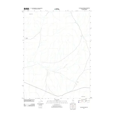
2011 Map of Sugarloaf Knob
USGS Topo · Published 2011About this map
Sugarloaf Knob rises as a prominent landmark within this high-desert landscape of Humboldt County, defining the northern reaches of a quadrangle characterized by its remote drainage networks and intermittent water sources. The area is anchored by the southern stretch of the Antelope Range, where the terrain transitions into the broad expanse of Antelope. Natural water sources, critical for the survival of early livestock and travelers in this arid region, are documented at Fox Spring and Smokey Spring. The topography is further etched by the deep incision of Woods Canyon, which cuts through the western portion of the map. This 2011 survey illustrates the modern road network overlaying a landscape where physical geography—specifically the ridges and springs—historically dictated the movement of people and animals across the Great Basin.
Find a feature on this map
6 named features on this map. Tap any name to fly to it.
Don’t see what you’re looking for? This feature index may not catch every label — zoom into the map to look around manually.
Map Details
Editions of this 2011 Sugarloaf Knob Map
This is the sole edition of this map. No revisions or reprints were ever made.
Other maps of this area

1886 · Disaster
USGS Topo · 1:250,000

1893 · Disaster
USGS Topo · 1:250,000

1931 · Lovelock
USGS Topo · 1:250,000

1935 · Lovelock
USGS Topo · 1:250,000

1954 · Vya
USGS Topo · 1:250,000

1955 · Lovelock
USGS Topo · 1:250,000

1958 · Vya
USGS Topo · 1:250,000

1959 · Lovelock
USGS Topo · 1:250,000

1962 · Vya
USGS Topo · 1:250,000

1966 · Donna Schee Peak
USGS Topo · 1:62,500