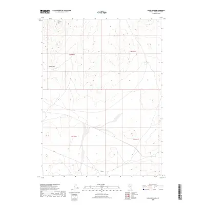
2018 Map of Sugarloaf Knob
USGS Topo · Published 2018About this map
Sugarloaf Knob rises as a prominent landmark in this desert reach of Humboldt County, defining the high ground above the drainage of Woods Canyon. The landscape is characterized by its arid isolation, where water sources are vital but sparse markers on the terrain. Two such critical points, Fox Spring and Smokey Spring, are located in the northeastern portion of the quadrangle, likely serving as essential stops for travelers or livestock in the Great Basin environment. Human activity is largely represented by the passage of Jungo Rd, which cuts across the southern sections of the map. This thoroughfare links the remote basins and ranges, following the natural contours of the land while bypassing the steeper elevations of the northern hills. The map provides a clear look at the Public Land Survey System divisions, with the intersection of t36n r30e, t36n r31e, t35n r30e, and t35n r31e forming the primary cadastral framework.
Find a feature on this map
9 named features on this map. Tap any name to fly to it.
Don’t see what you’re looking for? This feature index may not catch every label — zoom into the map to look around manually.
Map Details
Editions of this 2018 Sugarloaf Knob Map
This is the sole edition of this map. No revisions or reprints were ever made.
Other maps of this area

1886 · Disaster
USGS Topo · 1:250,000

1893 · Disaster
USGS Topo · 1:250,000

1931 · Lovelock
USGS Topo · 1:250,000

1935 · Lovelock
USGS Topo · 1:250,000

1954 · Vya
USGS Topo · 1:250,000

1955 · Lovelock
USGS Topo · 1:250,000

1958 · Vya
USGS Topo · 1:250,000

1959 · Lovelock
USGS Topo · 1:250,000

1962 · Vya
USGS Topo · 1:250,000

1966 · Donna Schee Peak
USGS Topo · 1:62,500