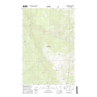
2017 Map of Sugarloaf Peak
USGS Topo · Published 2017About this map
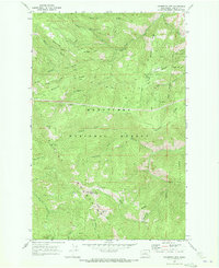
The Entiat Mountains dominate this section of the Wenatchee National Forest, where a high-elevation drainage system feeds the Mad River. The landscape is defined by its steep ridges and peaks, most notably Sugarloaf Peak and Maverick Peak, which serve as prominent navigational landmarks in this corner of the Cascades. Deep within the drainage, the Lower Mad River winds through narrow valleys, flanked by family-named and topographic features like McDonald Ridge and Billy Ridge. Forest access is facilitated by a network of service roads, including the Entiat Summit Rd and Natl Forest Develop Road 6104 Rd, which navigate the elevation changes between the peaks and lower meadows. Small seasonal water sources like Jimmy Creek and Billy Creek branch off the main river system, while Morrow Meadow provides a rare break in the vertical topography near Maverick Saddle.
Find a feature on this map
43 named features on this map. Tap any name to fly to it.
Don’t see what you’re looking for? This feature index may not catch every label — zoom into the map to look around manually.
Map Details
Editions of this 2017 Sugarloaf Peak Map
This is the sole edition of this map. No revisions or reprints were ever made.
Other maps of this area

1901 · Chelan
USGS Topo · 1:125,000

1901 · Chiwaukum
USGS Topo · 1:125,000

1904 · Chiwaukum
USGS Topo · 1:125,000

1957 · Wenatchee
USGS Topo · 1:250,000

1964 · Leavenworth
USGS Topo · 1:62,500
1968 · Silver Falls
USGS Topo · 1:24,000

1968 · Tyee Mtn.
USGS Topo · 1:24,000
1968 · Sugarloaf Peak
USGS Topo · 1:24,000
1968 · Plain
USGS Topo · 1:24,000
1968 · Chumstick Mtn
USGS Topo · 1:24,000