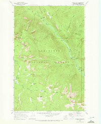
1968 Map of Silver Falls
USGS Topo · Published 1972About this map
Wenatchee National Forest dominates the landscape of this 1968 survey, where the Entiat River carves a deep valley through the Entiat MTS. The mapping reflects a region managed for both conservation and recreation, evidenced by the network of Pack Trail segments and numerous designated campsites like Silver Falls Campground and Fox Creek Campground. A dedicated Forest Service Station and various Guard Station and Lookout points underscore the administrative presence in this high-elevation backcountry.
Find a feature on this map
57 named features on this map. Tap any name to fly to it.
Don’t see what you’re looking for? This feature index may not catch every label — zoom into the map to look around manually.
Map Details
Editions of this 1968 Silver Falls Map
Other maps of this area

1899 · Methow
USGS Topo · 1:125,000

1901 · Chelan
USGS Topo · 1:125,000

1901 · Methow
USGS Topo · 1:125,000

1901 · Chiwaukum
USGS Topo · 1:125,000

1902 · Stehekin
USGS Topo · 1:125,000

1904 · Stehekin
USGS Topo · 1:125,000

1904 · Chiwaukum
USGS Topo · 1:125,000

1944 · Lucerne
USGS Topo · 1:62,500

1949 · Lucerne
USGS Topo · 1:62,500

1955 · Concrete
USGS Topo · 1:250,000