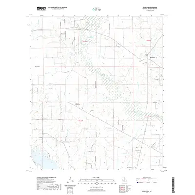
2020 Map of Sugartown
USGS Topo · Published 2020About this map
Sugartown and its surrounding rural landscapes in Beauregard Parish are defined by a dense network of watercourses, dominated by the winding path of Whisky Chitto Creek and its many tributaries like Little Sugar Creek and Bear Slough. This region exhibits a traditional settlement pattern where community life centers on family-named roads and rural institutions. The map preserves the locations of several important local landmarks, including the Sugartown Baptist Church and the Sugartown Lookout Tower. Genealogists will find significant value in the distribution of burial grounds across the township, from the New Campground Cem to the Smyrna Old Cole Cem. The southern edge of the quadrangle touches Bundick Lake, while the interior is etched with numerous named gullies and prongs, such as Jumping Gully and Short Prong, illustrating the intricate drainage system of this piney woods territory.
Find a feature on this map
89 named features on this map. Tap any name to fly to it.
Don’t see what you’re looking for? This feature index may not catch every label — zoom into the map to look around manually.
Map Details
Editions of this 2020 Sugartown Map
This is the sole edition of this map. No revisions or reprints were ever made.
Other maps of this area

1935 · Mittie
USGS Topo · 1:31,680

1947 · Ikes
USGS Topo · 1:31,680

1947 · Chasmore
USGS Topo · 1:31,680

1947 · Grant
USGS Topo · 1:31,680

1947 · Bundick
USGS Topo · 1:31,680

1947 · Sugartown
USGS Topo · 1:31,680

1947 · Bannister
USGS Topo · 1:31,680

1947 · Sugrue
USGS Topo · 1:31,680

1947 · Pitkin
USGS Topo · 1:31,680

1948 · Grant
USGS Topo · 1:24,000