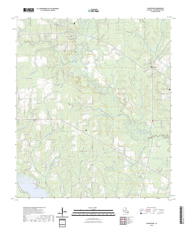
2024 Map of Sugartown
USGS Topo · Published 2024About this map
Sugartown remains a central settlement in this portion of Beauregard Parish, situated amidst a landscape defined by the meandering course of Whisky Chitto Creek and its many tributaries. For those researching family history in this area, the map provides precise locations for several burial grounds, including the Sugartown Baptist Church Cem, Smyrna Old Cole Cem, and the Hoy Cem. The geography is characterized by intricate drainage systems such as Bear Slough and Deep Slough, which feed into larger bodies like Sugar Creek and the southern Bundick Lake. This recent survey reveals a rural infrastructure of family-named roads, including Wade Cooley Rd and Elzie Welch Rd, reflecting the long-standing community ties to the land. The distribution of these roads and small cemeteries suggests a settlement pattern that follows the high ground between the creek bottoms and the sloughs.
Find a feature on this map
93 named features on this map. Tap any name to fly to it.
Don’t see what you’re looking for? This feature index may not catch every label — zoom into the map to look around manually.
Map Details
Editions of this 2024 Sugartown Map
This is the sole edition of this map. No revisions or reprints were ever made.
Other maps of this area

1935 · Mittie
USGS Topo · 1:31,680

1947 · Ikes
USGS Topo · 1:31,680

1947 · Chasmore
USGS Topo · 1:31,680

1947 · Grant
USGS Topo · 1:31,680

1947 · Bundick
USGS Topo · 1:31,680

1947 · Sugartown
USGS Topo · 1:31,680

1947 · Bannister
USGS Topo · 1:31,680

1947 · Sugrue
USGS Topo · 1:31,680

1947 · Pitkin
USGS Topo · 1:31,680

1948 · Grant
USGS Topo · 1:24,000