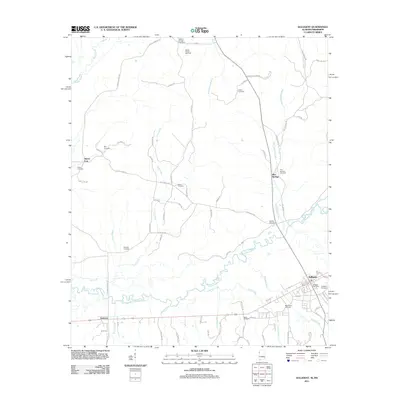
2011 Map of Sulligent
USGS Topo · Published 2011About this map
Sulligent and Gattman anchor the southern reaches of this landscape where the Alabama and Mississippi state line divides the winding Buttahatchee River valley. This 2011 survey captures the area's rural character and resource-based economy, notably the Wesley Chapel Gas Field in the north and the cluster of residential streets in Sulligent, including Front St and Walnut St. The river and its tributaries, such as Moors Creek, Turkey Creek, and Lost Creek, dictate the geography, while a dense network of country roads connects family settlements and historical landmarks. Genealogists will find a wealth of data in the many local burial grounds, from the Wesley Chapel Cemetery near the northern boundary to Macedonia Cemetery and Hollis Cemetery further south. The Sulligent Post Office remains a central hub for the community, while smaller hamlets like Pine Springs and Sipsey Fork mark the quiet crossroads of the backcountry.
Find a feature on this map
79 named features on this map. Tap any name to fly to it.
Don’t see what you’re looking for? This feature index may not catch every label — zoom into the map to look around manually.
Map Details
Editions of this 2011 Sulligent Map
This is the sole edition of this map. No revisions or reprints were ever made.
Other maps of this area

1953 · West Point
USGS Topo · 1:250,000

1956 · Tupelo
USGS Topo · 1:250,000

1958 · Tupelo
USGS Topo · 1:250,000

1958 · West Point
USGS Topo · 1:250,000

1963 · West Point
USGS Topo · 1:250,000

1966 · Turon
USGS Topo · 1:24,000

1966 · Greenwood Springs
USGS Topo · 1:24,000

1966 · Amory SE
USGS Topo · 1:24,000

1967 · Sulligent
USGS Topo · 1:24,000

1967 · Beaverton
USGS Topo · 1:24,000