
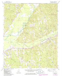
1967 Map of Beaverton
USGS Topo · Published 1968About this map
The Buttahatchee River meanders through this portion of Lamar County, defining a landscape of narrow bottomlands and dissected uplands during the late 1960s. The St Louis - San Francisco railroad serves as the primary industrial axis, connecting the settlements of Beaverton, Crews, and the eastern edge of Sulligent. This corridor is characterized by a concentrated pattern of extraction, with numerous Gravel Pits dotting the terrain near the rail line and river crossings.
Find a feature on this map
40 named features on this map. Tap any name to fly to it.
Don’t see what you’re looking for? This feature index may not catch every label — zoom into the map to look around manually.
Map Details
Editions of this 1967 Beaverton Map
2 editions found
Other maps of this area

1953 · Birmingham
USGS Topo · 1:250,000

1953 · West Point
USGS Topo · 1:250,000

1956 · Birmingham
USGS Topo · 1:250,000

1956 · Gadsden
USGS Topo · 1:250,000

1956 · Tupelo
USGS Topo · 1:250,000

1957 · Birmingham
USGS Topo · 1:250,000

1958 · Tupelo
USGS Topo · 1:250,000

1958 · West Point
USGS Topo · 1:250,000

1958 · Gadsden
USGS Topo · 1:250,000

1960 · Gadsden
USGS Topo · 1:250,000