1957 Map of Birmingham
USGS Topo · Published 1957About this map
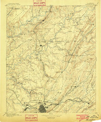
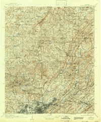
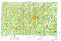
Birmingham serves as the industrial and urban anchor for North-Central Alabama during this mid-century period, its growth shaped by the ridgelines of Red Mountain and the surrounding Jones Valley. The map illustrates a densely interconnected region of iron and steel production, with satellite cities like Bessemer, Fairfield, and Tarrant City following the seams of the valley floor. To the west, the University of Alabama marks the expansion of Tuscaloosa along the Black Warrior River, while the northern and eastern reaches are dominated by the extensive timberlands of the Talladega National Forest and the William B Bankhead National Forest.
Find a feature on this map
281 named features on this map. Tap any name to fly to it.
Don’t see what you’re looking for? This feature index may not catch every label — zoom into the map to look around manually.
Map Details
Editions of this 1957 Birmingham Map
This is the sole edition of this map. No revisions or reprints were ever made.
Historical Maps of Birmingham Through Time
7 maps found