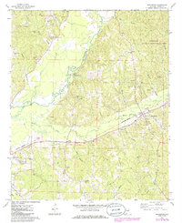
1967 Map of Beaverton
USGS Topo · Published 1986About this map
The Buttahatchee River meanders through the heart of this Lamar County landscape, defining the topography of western Alabama during the mid-to-late twentieth century. The river's winding path is flanked by numerous tributaries, including Beaver Creek and Mill Creek, which historically supported the region's agricultural and rural development. The Burlington Northern railroad serves as a primary industrial artery, connecting the settlements of Beaverton and Crews.
Find a feature on this map
37 named features on this map. Tap any name to fly to it.
Don’t see what you’re looking for? This feature index may not catch every label — zoom into the map to look around manually.
Map Details
Editions of this 1967 Beaverton Map
2 editions found

Other maps of this area

1953 · Birmingham
USGS Topo · 1:250,000

1953 · West Point
USGS Topo · 1:250,000

1956 · Birmingham
USGS Topo · 1:250,000

1956 · Gadsden
USGS Topo · 1:250,000

1956 · Tupelo
USGS Topo · 1:250,000

1957 · Birmingham
USGS Topo · 1:250,000

1958 · Tupelo
USGS Topo · 1:250,000

1958 · West Point
USGS Topo · 1:250,000

1958 · Gadsden
USGS Topo · 1:250,000

1960 · Gadsden
USGS Topo · 1:250,000