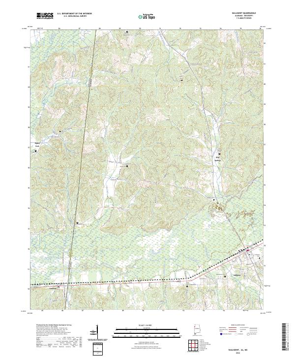
2024 Map of Sulligent
USGS Topo · Published 2024About this map
The Buttahatchee River meanders across the state line between Alabama and Mississippi, anchoring a landscape defined by small cross-border communities. Centered on Sulligent in Lamar County, this modern survey illustrates a network of rural roads and drainage systems like Bogue Creek and Lost Creek that have shaped local movement for generations. The geography is punctuated by small, family-named burial grounds and churches such as Macedonia Cem and Wesley Chapel Cem, which offer significant data points for genealogists tracing regional lineages. To the west, the settlement of Gattman sits just over the state line, while further north, the map identifies small clusters like Pine Springs and Sipsey Fork. Notable infrastructure including the Dinky Line Rd and Us HWY 278 provides a clear view of the modern transportation corridor that links these timbered hills and bottomlands.
Find a feature on this map
84 named features on this map. Tap any name to fly to it.
Don’t see what you’re looking for? This feature index may not catch every label — zoom into the map to look around manually.
Map Details
Editions of this 2024 Sulligent Map
This is the sole edition of this map. No revisions or reprints were ever made.
Other maps of this area

1953 · West Point
USGS Topo · 1:250,000

1956 · Tupelo
USGS Topo · 1:250,000

1958 · Tupelo
USGS Topo · 1:250,000

1958 · West Point
USGS Topo · 1:250,000

1963 · West Point
USGS Topo · 1:250,000

1966 · Turon
USGS Topo · 1:24,000

1966 · Greenwood Springs
USGS Topo · 1:24,000

1966 · Amory SE
USGS Topo · 1:24,000

1967 · Sulligent
USGS Topo · 1:24,000

1967 · Beaverton
USGS Topo · 1:24,000