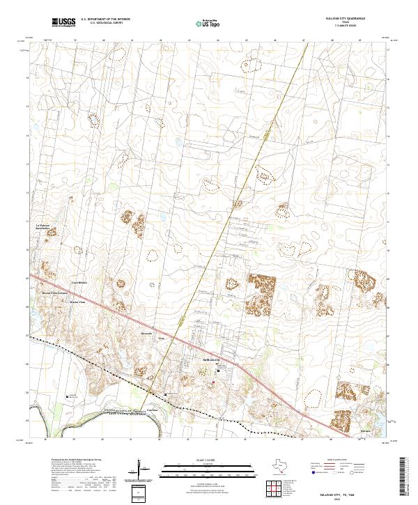
2022 Map of Sullivan City
USGS Topo · Published 2022About this map
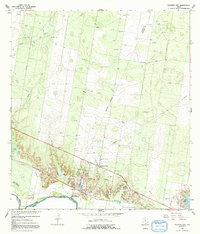
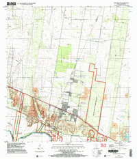
Sullivan City serves as a central hub on this South Texas borderland survey, situated just north of the Rio Grande where the Starr Co Hidalgo Co line bisects the landscape. The region is defined by a dense network of ranch roads and residential colonias that branch off the primary thoroughfares, including Old Military Rd and Military Rd. Local heritage is anchored by several family-named landmarks such as the Artesitas Ranch Cem, Cuevitas Cem, and Benavides Ranch Cem. These burial grounds, alongside small settlements like Cuevitas and Havana, suggest deep-rooted generational ties to the land. The terrain north of the river is marked by numerous ephemeral water bodies and creeks like Salado Cr, emphasizing the importance of traditional ranching boundaries and irrigation in this semi-arid environment.
Find a feature on this map
57 named features on this map. Tap any name to fly to it.
Don’t see what you’re looking for? This feature index may not catch every label — zoom into the map to look around manually.
Map Details
Editions of this 2022 Sullivan City Map
This is the sole edition of this map. No revisions or reprints were ever made.
Historical Maps of Valle Vista Colonia Through Time
3 maps found