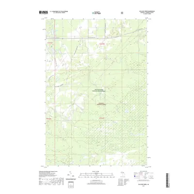
2019 Map of Sullivan Creek
USGS Topo · Published 2019About this map
Hiawatha National Forest dominates this section of the Upper Peninsula, characterized by a complex network of wetlands and small glacial lakes. The Sullivan Creek National Fish Hatchery stands as a focal point of resource management within these woods, situated near the headwaters of Sullivan Cr. The landscape is a haven for modern recreation, marked by the long-distance N Country National Scenic Trail and several specialized vehicle paths, including the Raco-Strongs Sorva Route and the Soo-Raco Sorva Route. Numerous named water bodies like Soldier Lake, High Banks Lake, and Toy Soldier Lake are clustered in the northern sections, while the south is defined by the drainage of the N Pine River and Black Cr. These features illustrate the area's transition from historical timber production to its contemporary role in conservation and outdoor recreation.
Find a feature on this map
28 named features on this map. Tap any name to fly to it.
Don’t see what you’re looking for? This feature index may not catch every label — zoom into the map to look around manually.
Map Details
Editions of this 2019 Sullivan Creek Map
This is the sole edition of this map. No revisions or reprints were ever made.
Other maps of this area

1941 · Strongs
USGS Topo · 1:63,360

1941 · Brimley
USGS Topo · 1:63,360

1951 · Strongs
USGS Topo · 1:24,000

1951 · McNearney Lake
USGS Topo · 1:24,000

1951 · Pendills Lake
USGS Topo · 1:24,000

1951 · Dollar Settlement
USGS Topo · 1:24,000

1951 · Sullivan Creek
USGS Topo · 1:24,000

1951 · Raco
USGS Topo · 1:24,000

1951 · Brimley
USGS Topo · 1:62,500

1951 · Strongs
USGS Topo · 1:62,500
Featured Places
- Kinross Township, MI
- Superior Township, MI
- Trout Lake Township, MI
- Chippewa Township, MI
- Chippewa County, MI