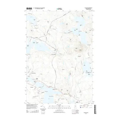
2014 Map of Sullivan
USGS Topo · Published 2014About this map
Sullivan Harbor and the complex tidal waters of Hog Bay anchor this coastal landscape, where the rugged shoreline of Hancock meets the interior peaks of Schoodic Mtn and Fiery Mtn. This modern survey documents the established village centers of Sullivan, Franklin, and Waukeag, showing a transition from the salt-water economy of the coast to the forested inland ponds like Georges Pond and Flanders Pond. The area is characterized by its numerous family and community burial grounds, including York Hill Cem, Blaisdell Cem, and Salter Cem, which provide a detailed genealogical record of the region's long-standing residents.
Find a feature on this map
142 named features on this map. Tap any name to fly to it.
Don’t see what you’re looking for? This feature index may not catch every label — zoom into the map to look around manually.
Map Details
Editions of this 2014 Sullivan Map
This is the sole edition of this map. No revisions or reprints were ever made.
Other maps of this area

1904 · Mount Desert
USGS Topo · 1:62,500

1904 · Bar Harbor
USGS Topo · 1:62,500

1911 · Ellsworth
USGS Topo · 1:62,500

1930 · Tunk Lake
USGS Topo · 1:48,000

1932 · Tunk Lake
USGS Topo · 1:62,500

1940 · Ellsworth
USGS Topo · 1:62,500

1942 · Bar Harbor
USGS Topo · 1:62,500

1942 · Ellsworth
USGS Topo · 1:62,500

1942 · Mount Desert
USGS Topo · 1:62,500

1942 · Tunk Lake
USGS Topo · 1:62,500