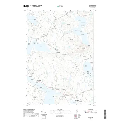
2021 Map of Sullivan
USGS Topo · Published 2021About this map
The Hancock-Sullivan Bridge spans the tidal narrows where Sullivan Harbor meets Taunton Bay, a focal point of the coastline in this 2021 survey. This maritime landscape is defined by its numerous small inlets and points, including Julius Darling Point and Shipyard Point, where the geography historically supported local fishing and shipbuilding. The area around Sullivan and Waukeag is rich with genealogical data, evidenced by a dense collection of family and community burial sites such as York Hill Cem, Salter Cem, and Sumner Cem.
Find a feature on this map
164 named features on this map. Tap any name to fly to it.
Don’t see what you’re looking for? This feature index may not catch every label — zoom into the map to look around manually.
Map Details
Editions of this 2021 Sullivan Map
This is the sole edition of this map. No revisions or reprints were ever made.
Other maps of this area

1904 · Mount Desert
USGS Topo · 1:62,500

1904 · Bar Harbor
USGS Topo · 1:62,500

1911 · Ellsworth
USGS Topo · 1:62,500

1930 · Tunk Lake
USGS Topo · 1:48,000

1932 · Tunk Lake
USGS Topo · 1:62,500

1940 · Ellsworth
USGS Topo · 1:62,500

1942 · Bar Harbor
USGS Topo · 1:62,500

1942 · Ellsworth
USGS Topo · 1:62,500

1942 · Mount Desert
USGS Topo · 1:62,500

1942 · Tunk Lake
USGS Topo · 1:62,500