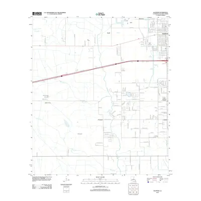
2012 Map of Sulphur
USGS Topo · Published 2012About this map
The industrial and marshland character of Calcasieu Parish is evident in this detailed view of Sulphur and its surrounding communities. The landscape is defined by a dense network of water management and extraction features, from the North Choupique Oil and Gas Field in the west to the Drew Canal and the meandering Bayou Choupique. These waterways slice through the low-lying terrain of Pine Island and the Little Calcasieu Prairie, illustrating the region's complex coastal hydrology.
Find a feature on this map
71 named features on this map. Tap any name to fly to it.
Don’t see what you’re looking for? This feature index may not catch every label — zoom into the map to look around manually.
Map Details
Editions of this 2012 Sulphur Map
This is the sole edition of this map. No revisions or reprints were ever made.
Other maps of this area

1932 · Moss Lake
USGS Topo · 1:31,680

1932 · Orange
USGS Topo · 1:62,500

1935 · Buhler
USGS Topo · 1:31,680

1946 · Moss Lake
USGS Topo · 1:31,680

1947 · Sulphur
USGS Topo · 1:31,680

1947 · Vinton
USGS Topo · 1:31,680

1947 · Sulphur Mines
USGS Topo · 1:31,680
1947 · West Lake
USGS Topo · 1:31,680

1947 · Lunita
USGS Topo · 1:31,680
1949 · Cameron Farms
USGS Topo · 1:31,680