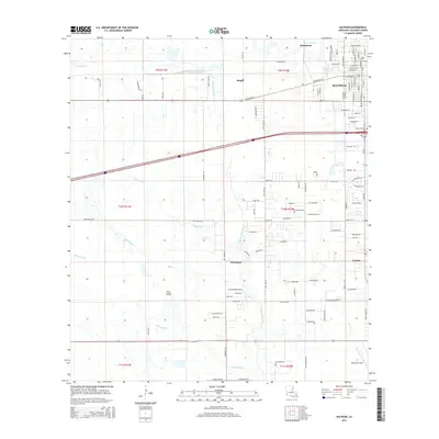
2015 Map of Sulphur
USGS Topo · Published 2015About this map
Sulphur and its surrounding communities in Calcasieu Parish are defined by a network of waterways and a dense grid of residential expansion just south of the historic mining area near Brimstone. The landscape is etched with the courses of Bayou d'Inde and Bayou Choupique, which snake through the low-lying terrain alongside drainage features like Wing Gully and Drew Canal. To the south, the settlement of Carlyss and the aviation grounds at Southland Field mark the transition toward more open coastal prairie, including the distinct terrain of Pine Island. Local heritage is anchored by sites such as Roseland Cem and the small siding at Stegall. The map reveals the intricate residential street layout of modern Sulphur, contrasting with the large-block rural tracts that still characterize the areas near Choupique and the Spring Gully drainage.
Find a feature on this map
103 named features on this map. Tap any name to fly to it.
Don’t see what you’re looking for? This feature index may not catch every label — zoom into the map to look around manually.
Map Details
Editions of this 2015 Sulphur Map
This is the sole edition of this map. No revisions or reprints were ever made.
Other maps of this area

1932 · Moss Lake
USGS Topo · 1:31,680

1932 · Orange
USGS Topo · 1:62,500

1935 · Buhler
USGS Topo · 1:31,680

1946 · Moss Lake
USGS Topo · 1:31,680

1947 · Sulphur
USGS Topo · 1:31,680

1947 · Vinton
USGS Topo · 1:31,680

1947 · Sulphur Mines
USGS Topo · 1:31,680
1947 · West Lake
USGS Topo · 1:31,680

1947 · Lunita
USGS Topo · 1:31,680
1949 · Cameron Farms
USGS Topo · 1:31,680