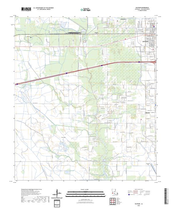
2024 Map of Sulphur
USGS Topo · Published 2024About this map
Sulphur and its surrounding communities are defined by a complex network of coastal waterways and industrial development in this modern survey. The landscape is segmented by significant drainage and transport corridors, including Bayou d'Inde to the north and the extensive Bayou Choupique which meanders through the central and southern reaches. Notable for its industrial history, the area near Brimstone and Stegall highlights the region's connection to mineral extraction, while the aviation facilities at Southland Field serve the growing southern outskirts near Carlyss. Genealogy and local history researchers can locate specific burial grounds such as Edgerly Cem in the northwest and Roselawn Cem to the east. The terrain includes named elevations like Pine Island, rising above a system of gullies and canals including Wing Gully and the Drew Canal, which illustrate the ongoing efforts to manage the water levels of Calcasieu Parish.
Find a feature on this map
78 named features on this map. Tap any name to fly to it.
Don’t see what you’re looking for? This feature index may not catch every label — zoom into the map to look around manually.
Map Details
Editions of this 2024 Sulphur Map
This is the sole edition of this map. No revisions or reprints were ever made.
Other maps of this area

1932 · Moss Lake
USGS Topo · 1:31,680

1932 · Orange
USGS Topo · 1:62,500

1935 · Buhler
USGS Topo · 1:31,680

1946 · Moss Lake
USGS Topo · 1:31,680

1947 · Sulphur
USGS Topo · 1:31,680

1947 · Vinton
USGS Topo · 1:31,680

1947 · Sulphur Mines
USGS Topo · 1:31,680
1947 · West Lake
USGS Topo · 1:31,680

1947 · Lunita
USGS Topo · 1:31,680
1949 · Cameron Farms
USGS Topo · 1:31,680