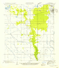
1954 Map of Sulphur
USGS Topo · Published 1954About this map
Sulphur and its industrial surroundings appear in detail on this mid-century survey based on field examinations dating back to 1932. The landscape is defined by its drainage and transport infrastructure, notably the Southern Pacific railroad line and the corridor of Bayou Choupique. The map records specific early infrastructure, including the Gulf States Utilities Transmission Line and several waterways such as Drew Canal and the Sabine Canal. To the south, the Choupique Sch serves the local community near Carlyss, while the intriguing name Brimstone sits along the rail line west of the main settlement. The presence of an Abandoned Canal suggests the shifting water management needs of the Calcasieu Parish landscape during this era of development.
Find a feature on this map
18 named features on this map. Tap any name to fly to it.
Don’t see what you’re looking for? This feature index may not catch every label — zoom into the map to look around manually.
Map Details
Editions of this 1954 Sulphur Map
This is the sole edition of this map. No revisions or reprints were ever made.
Other maps of this area

1932 · Moss Lake
USGS Topo · 1:31,680

1932 · Orange
USGS Topo · 1:62,500

1935 · Buhler
USGS Topo · 1:31,680

1946 · Moss Lake
USGS Topo · 1:31,680

1947 · Sulphur
USGS Topo · 1:31,680

1947 · Vinton
USGS Topo · 1:31,680

1947 · Sulphur Mines
USGS Topo · 1:31,680
1947 · West Lake
USGS Topo · 1:31,680

1947 · Lunita
USGS Topo · 1:31,680
1949 · Cameron Farms
USGS Topo · 1:31,680