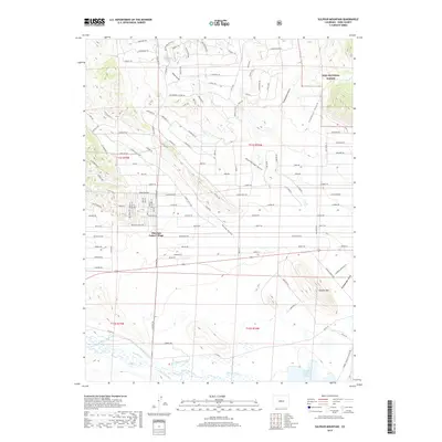
2019 Map of Sulphur Mountain
USGS Topo · Published 2019About this map
Pike-San Isabel Village stands at the heart of this Park County landscape, where the residential grid meets the open terrain of the Pike National Forest. The map documents a sophisticated system of water management essential to this high-altitude environment, featuring the Western Ditch, Fritz Ditch, and Harrington-Rikard Ditch which channel the flows of the South Fork South Platte River. To the southeast, the Spinney Mountain Reservoir provides a major hydrological anchor, while the prominent Sulphur Mtn rises above the surrounding gulches.
Find a feature on this map
111 named features on this map. Tap any name to fly to it.
Don’t see what you’re looking for? This feature index may not catch every label — zoom into the map to look around manually.
Map Details
Editions of this 2019 Sulphur Mountain Map
This is the sole edition of this map. No revisions or reprints were ever made.
Other maps of this area

1953 · Denver
USGS Topo · 1:250,000

1954 · Pueblo
USGS Topo · 1:250,000

1956 · Eagle Rock
USGS Topo · 1:24,000

1956 · Elkhorn
USGS Topo · 1:24,000

1956 · Sulphur Mountain
USGS Topo · 1:24,000

1956 · Farnum Peak
USGS Topo · 1:24,000

1956 · Antero Reservoir NE
USGS Topo · 1:24,000

1956 · Hartsel
USGS Topo · 1:24,000

1956 · Guffey NW
USGS Topo · 1:24,000

1956 · Glentivar
USGS Topo · 1:24,000