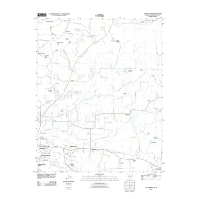
2011 Map of Sulphur Rock
USGS Topo · Published 2011About this map
Batesville and its eastern suburbs form the anchor of this 2011 survey, showing the residential expansion into Rogers Addition and College Heights Addition. The landscape is a mix of suburban development and the deep-rooted mining history of Independence County. Numerous manganese and mineral works such as the Ozark Mine and Matheny Mine are documented in the hills north of Pfeiffer, while several prospects like the Silberstein Prospect and Dunegan Prospect suggest the region's extractive past. Away from the town center, the terrain is dotted with family and community burial grounds, including Lees Chapel Cemetery and Weaver's Cemetery. Small rural hubs like Gainsboro and Sharp remain connected by a network of creeks, most notably Miller Creek and Dota Creek, which drain the undulating lands near the southern reaches of Sulphur Rock.
Find a feature on this map
151 named features on this map. Tap any name to fly to it.
Don’t see what you’re looking for? This feature index may not catch every label — zoom into the map to look around manually.
Map Details
Editions of this 2011 Sulphur Rock Map
This is the sole edition of this map. No revisions or reprints were ever made.
Other maps of this area

1890 · Batesville
USGS Topo · 1:125,000

1891 · Batesville
USGS Topo · 1:125,000

1932 · Strawberry
USGS Topo · 1:62,500

1935 · Strawberry
USGS Topo · 1:62,500

1935 · Newport
USGS Topo · 1:62,500

1941 · Strawberry
USGS Topo · 1:62,500

1942 · Jamestown
USGS Topo · 1:31,680

1942 · Salado
USGS Topo · 1:31,680

1942 · Batesville
USGS Topo · 1:31,680

1943 · Sandtown
USGS Topo · 1:24,000