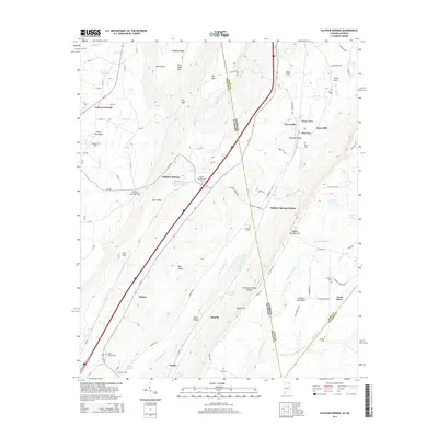
2014 Map of Sulphur Springs
USGS Topo · Published 2014About this map
Battelle and the surrounding valley along the Alabama and Georgia border showcase a landscape deeply defined by its geography and small settlements. The area is characterized by the Tennessee Valley Divide, where water flows through complex systems like W Fork Lookout Cr and the W Fork Little River. Local history is visible through numerous family and community landmarks, including Amos Mill and a high concentration of burial sites such as Head Springs Cem and Pannell Cem. The topography is shaped by the presence of Sand Mountain and the deep cuts of Atkins Gulf and Tatum Gulf. Evidence of early transportation and resource utilization remains in place names like Kaolin, Sulphur Springs Station, and the nearby White Sulphur Spring. This survey provides an essential view of the borderlands where the Lookout Mountain range meets the settled valleys of DeKalb County.
Find a feature on this map
92 named features on this map. Tap any name to fly to it.
Don’t see what you’re looking for? This feature index may not catch every label — zoom into the map to look around manually.
Map Details
Editions of this 2014 Sulphur Springs Map
This is the sole edition of this map. No revisions or reprints were ever made.
Other maps of this area

1886 · Ringgold
USGS Topo · 1:125,000

1886 · Stevenson
USGS Topo · 1:125,000

1892 · Ringgold
USGS Topo · 1:125,000

1892 · Stevenson
USGS Topo · 1:125,000

1895 · Stevenson
USGS Topo · 1:125,000

1935 · Durham
USGS Topo · 1:24,000

1936 · Trenton
USGS Topo · 1:24,000

1936 · Ider
USGS Topo · 1:24,000

1936 · Flat Rock
USGS Topo · 1:24,000

1936 · Dugout Valley
USGS Topo · 1:24,000