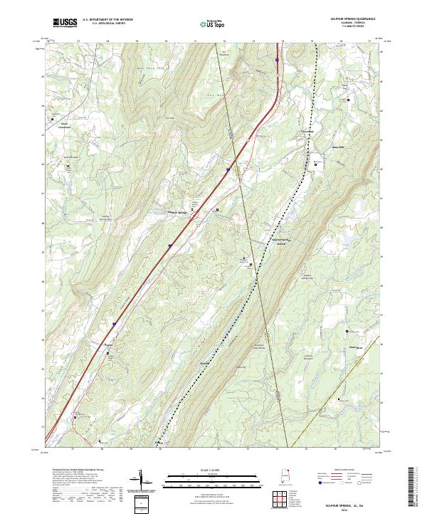
2024 Map of Sulphur Springs
USGS Topo · Published 2024About this map
The Tennessee Valley Divide anchors this detailed study of the plateau and valley systems along the Alabama and Georgia border. The landscape is defined by the prominent Sand Mountain and Lookout Mountain, separated by the deep corridors of Dugout Valley and Sand Valley. This topography shaped early settlement patterns, with communities like Sulphur Springs and Battelle concentrated near water sources and along the base of the ridges. Numerous small family and community burial grounds, such as the Finlayson Family Cem, Gardner Cem, and Hartline Cem, are preserved across the terrain, offering significant primary data for local genealogists.
Find a feature on this map
119 named features on this map. Tap any name to fly to it.
Don’t see what you’re looking for? This feature index may not catch every label — zoom into the map to look around manually.
Map Details
Editions of this 2024 Sulphur Springs Map
This is the sole edition of this map. No revisions or reprints were ever made.
Other maps of this area

1886 · Ringgold
USGS Topo · 1:125,000

1886 · Stevenson
USGS Topo · 1:125,000

1892 · Ringgold
USGS Topo · 1:125,000

1892 · Stevenson
USGS Topo · 1:125,000

1895 · Stevenson
USGS Topo · 1:125,000

1935 · Durham
USGS Topo · 1:24,000

1936 · Trenton
USGS Topo · 1:24,000

1936 · Ider
USGS Topo · 1:24,000

1936 · Flat Rock
USGS Topo · 1:24,000

1936 · Dugout Valley
USGS Topo · 1:24,000