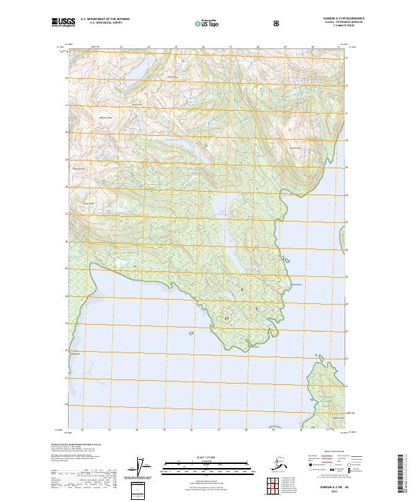
2024 Map of Sumdum A-3 SW
USGS Topo · Published 2024About this map
Tongass National Forest dominates this coastal landscape along the southeastern Alaskan panhandle, where high alpine summits meet the intricate shorelines of Thomas Bay. The terrain is defined by a series of prominent elevations, including Jefferson Peak, Rodman Peak, and Pierce Peak, which overlook remote glacial lakes such as De Boer Lake and Spurt Point Lake. Navigation and access in this wilderness are marked by coastal landforms like Point Vandeput and Spurt Point, while the Spurt Lake Trl offers a rare terrestrial route through the dense forest and complex topography. The presence of Ruth Island and the sheltered waters of Porter Cove illustrate the maritime character of this region, serving as a contemporary record of its untouched natural features and surveying boundaries.
Find a feature on this map
20 named features on this map. Tap any name to fly to it.
Don’t see what you’re looking for? This feature index may not catch every label — zoom into the map to look around manually.
Map Details
Editions of this 2024 Sumdum A-3 SW Map
This is the sole edition of this map. No revisions or reprints were ever made.
Other maps of this area

1948 · Sumdum A-4
USGS Topo · 1:63,360

1951 · Petersburg D-4
USGS Topo · 1:63,360

1951 · Sumdum A-4
USGS Topo · 1:63,360

1952 · Petersburg
USGS Topo · 1:250,000

1952 · Sumdum
USGS Topo · 1:250,000

1960 · Petersburg
USGS Topo · 1:250,000

1961 · Petersburg D-3
USGS Topo · 1:63,360

1961 · Sumdum A-3
USGS Topo · 1:63,360

1961 · Sumdum
USGS Topo · 1:250,000
1995 · Petersburg D-3
USGS Topo · 1:63,360