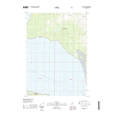
2021 Map of Sumdum A-4 SE
USGS Topo · Published 2021About this map
Franklin Peaks and Hamilton Peak rise above the coastal wilderness of Southeast Alaska in this topographic portrait of the Tongass National Forest. The landscape is defined by the sharp transition from the mountainous interior to the expansive waters of Frederick Sound along the southern coastline. This map details the intricate topography of the Missionary Range at the southern edge of the quadrangle, illustrating the steep coastal bluffs and glacial terrain characteristic of the Petersburg Borough. The lack of infrastructure or developed settlements highlights the isolation of this maritime environment, where the primary geographical markers are named summits and the deep tidal waters that serve as the region's main corridors.
Find a feature on this map
9 named features on this map. Tap any name to fly to it.
Don’t see what you’re looking for? This feature index may not catch every label — zoom into the map to look around manually.
Map Details
Editions of this 2021 Sumdum A-4 SE Map
This is the sole edition of this map. No revisions or reprints were ever made.
Other maps of this area

1948 · Sumdum A-4
USGS Topo · 1:63,360

1951 · Petersburg D-4
USGS Topo · 1:63,360

1951 · Sumdum A-4
USGS Topo · 1:63,360

1952 · Petersburg
USGS Topo · 1:250,000

1952 · Sumdum
USGS Topo · 1:250,000

1960 · Petersburg
USGS Topo · 1:250,000

1961 · Petersburg D-3
USGS Topo · 1:63,360

1961 · Sumdum A-3
USGS Topo · 1:63,360

1961 · Sumdum
USGS Topo · 1:250,000
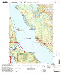
1995 · Petersburg D-3
USGS Topo · 1:63,360