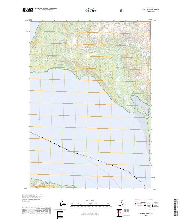
2024 Map of Sumdum A-4 SE
USGS Topo · Published 2024About this map
Tongass National Forest dominates the steep, mountainous landscape of this coastal Alaskan region, where the high ridges of Franklin Peaks and Hamilton Peak overlook the deep waters of Frederick Sound. The interaction between the maritime environment and the high-elevation terrain is evident in the drainage patterns leading toward Dry Bay, a protected cove on the northeastern edge of the sound. This 2024 topographic study reveals a largely roadless wilderness defined by extreme relief and the complex shoreline of Southeast Alaska's internal waterways. The map preserves the specific survey boundaries of t55s r77e and t55s r78e, documenting the spatial organization of this protected federal land within the Petersburg Borough.
Find a feature on this map
9 named features on this map. Tap any name to fly to it.
Don’t see what you’re looking for? This feature index may not catch every label — zoom into the map to look around manually.
Map Details
Editions of this 2024 Sumdum A-4 SE Map
This is the sole edition of this map. No revisions or reprints were ever made.
Other maps of this area

1948 · Sumdum A-4
USGS Topo · 1:63,360

1951 · Petersburg D-4
USGS Topo · 1:63,360

1951 · Sumdum A-4
USGS Topo · 1:63,360

1952 · Petersburg
USGS Topo · 1:250,000

1952 · Sumdum
USGS Topo · 1:250,000

1960 · Petersburg
USGS Topo · 1:250,000

1961 · Petersburg D-3
USGS Topo · 1:63,360

1961 · Sumdum A-3
USGS Topo · 1:63,360

1961 · Sumdum
USGS Topo · 1:250,000
1995 · Petersburg D-3
USGS Topo · 1:63,360