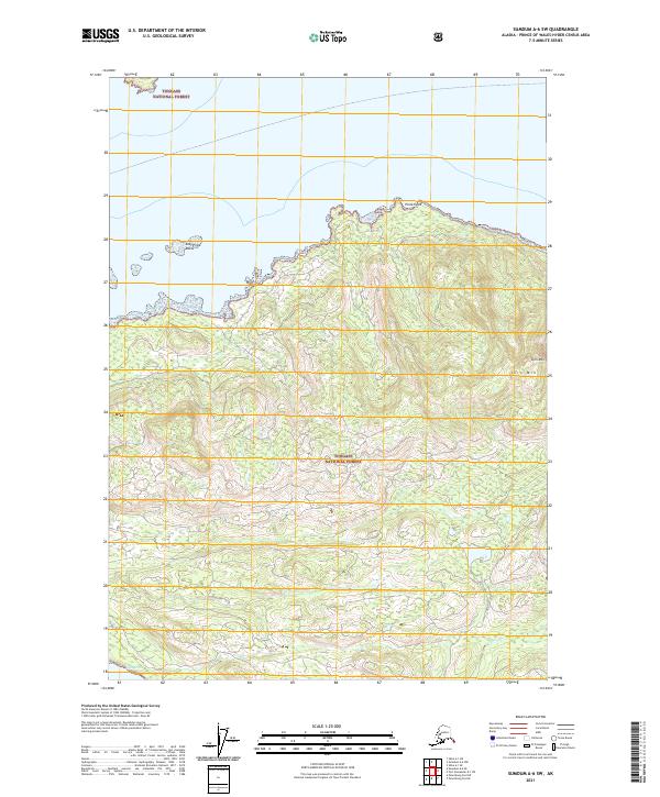
2021 Map of Sumdum A-6 SW
USGS Topo · Published 2021About this map
Tongass National Forest encompasses this coastal landscape, where the tides of Keku Strait meet a complex shoreline of points and offshore hazards. The interior terrain is defined by steep elevations and significant drainage systems, notably Gunnuk Cr in the southeast. While devoid of modern towns or settlements, the map provides a precise record of the natural landmarks essential for navigation and resource management in this part of Southeast Alaska. Prominent summits like Turn Mtn rise above the timbered slopes, serving as critical sightlines for those traversing the strait. The northern coastline is particularly intricate, marked by the rocky protrusion of Pinta Point and the nearby East Pinta Rocks, which present a rugged boundary between the forest and the sea.
Find a feature on this map
10 named features on this map. Tap any name to fly to it.
Don’t see what you’re looking for? This feature index may not catch every label — zoom into the map to look around manually.
Map Details
Editions of this 2021 Sumdum A-6 SW Map
This is the sole edition of this map. No revisions or reprints were ever made.
Other maps of this area

1948 · Sumdum A-6
USGS Topo · 1:63,360

1948 · Petersburg D-6
USGS Topo · 1:63,360

1948 · Port Alexander D-1
USGS Topo · 1:63,360

1948 · Sitka A-1
USGS Topo · 1:63,360

1951 · Sitka
USGS Topo · 1:250,000

1951 · Port Alexander
USGS Topo · 1:250,000

1951 · Petersburg D-6
USGS Topo · 1:63,360

1952 · Petersburg
USGS Topo · 1:250,000

1952 · Port Alexander
USGS Topo · 1:250,000

1952 · Sumdum
USGS Topo · 1:250,000