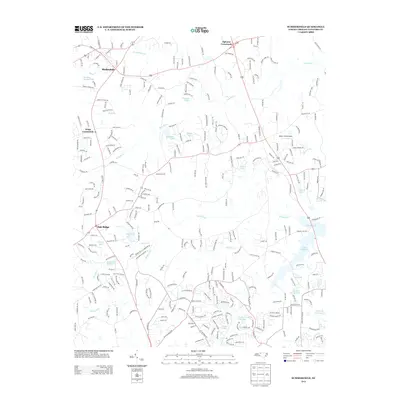
2013 Map of Summerfield
USGS Topo · Published 2013About this map
Stokesdale and Oak Ridge anchor this northwest Guilford County landscape, where the headwaters of the Haw River and the Reedy Fork create a complex network of streams and small impoundments. The map documents a rural-suburban transition as residential roads like Southard Rd and Flatrock Rd weave between older agricultural landmarks. Notable local centers include Ogburns Crossroads and Kings Crossroads, while religious and community life is represented by Moravia Church.
Find a feature on this map
286 named features on this map. Tap any name to fly to it.
Don’t see what you’re looking for? This feature index may not catch every label — zoom into the map to look around manually.
Map Details
Editions of this 2013 Summerfield Map
This is the sole edition of this map. No revisions or reprints were ever made.
Other maps of this area

1951 · Guilford
USGS Topo · 1:24,000

1951 · Lake Brandt
USGS Topo · 1:24,000

1951 · Greensboro
USGS Topo · 1:24,000

1953 · Winston-Salem
USGS Topo · 1:250,000

1953 · Greensboro
USGS Topo · 1:250,000

1954 · Greensboro
USGS Topo · 1:250,000

1955 · Winston-Salem
USGS Topo · 1:250,000

1962 · Winston-Salem
USGS Topo · 1:250,000

1962 · Greensboro
USGS Topo · 1:250,000

1966 · Greensboro
USGS Topo · 1:250,000