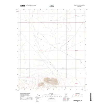
2023 Map of Summerford Mountain
USGS Topo · Published 2023About this map
Summerford Mountain and the Doña Ana Mountains dominate the southern landscape of this New Mexico quadrangle. This 2023 survey by the U.S. Geological Survey documents a high-desert terrain defined by significant elevation changes and the natural drainage of Lucero Arroyo. The map reveals a systematic grid of county roads, including Co RD e080, Co RD e078, and Co RD e085, which provide access through the sprawling sections of Township 19 South and Township 20 South. These transit lines indicate contemporary land management and ranching access across the arid plains leading toward the mountain foothills. The alignment of roads such as Co RD e084 and Co RD e079 reflects the integration of public land survey boundaries with modern infrastructure in this portion of Doña Ana County.
Find a feature on this map
15 named features on this map. Tap any name to fly to it.
Don’t see what you’re looking for? This feature index may not catch every label — zoom into the map to look around manually.
Map Details
Editions of this 2023 Summerford Mountain Map
This is the sole edition of this map. No revisions or reprints were ever made.
Other maps of this area

1891 · Las Cruces
USGS Topo · 1:125,000

1893 · Las Cruces
USGS Topo · 1:125,000

1916 · Tonuco
USGS Topo · 1:125,000

1932 · Tonuco
USGS Topo · 1:125,000

1941 · Las Cruces
USGS Topo · 1:62,500

1941 · Organ Peak
USGS Topo · 1:62,500

1943 · Organ Peak
USGS Topo · 1:62,500

1943 · Las Cruces
USGS Topo · 1:62,500

1948 · Bear Peak
USGS Topo · 1:62,500

1948 · San Diego Mountain
USGS Topo · 1:62,500