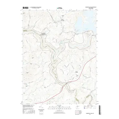
2016 Map of Summersville Dam
USGS Topo · Published 2016About this map
The Gauley River National Recreation Area dominates this landscape, where the river carves a winding path through the border of Nicholas and Fayette counties. The massive Summersville Dam and its resulting Summersville Lake manage the waters of the Gauley River, while further downstream, the river becomes a sequence of challenging whitewater, including Sweet Falls Rapids and Pillow Rock Rapids. These natural features have long shaped the settlement patterns of the region, from the upland plateau at Mount Lookout to the creek-side communities of Clifty and Hico.
Find a feature on this map
99 named features on this map. Tap any name to fly to it.
Don’t see what you’re looking for? This feature index may not catch every label — zoom into the map to look around manually.
Map Details
Editions of this 2016 Summersville Dam Map
This is the sole edition of this map. No revisions or reprints were ever made.
Other maps of this area

1889 · Nicholas
USGS Topo · 1:125,000

1891 · Nicholas
USGS Topo · 1:125,000

1897 · Kanawha Falls
USGS Topo · 1:125,000

1900 · Kanawha Falls
USGS Topo · 1:125,000

1901 · Nicholas
USGS Topo · 1:125,000

1901 · Kanawha Falls
USGS Topo · 1:125,000

1908 · Clay
USGS Topo · 1:48,000

1908 · Fayetteville
USGS Topo · 1:48,000

1910 · Clay
USGS Topo · 1:62,500

1910 · Fayetteville
USGS Topo · 1:62,500