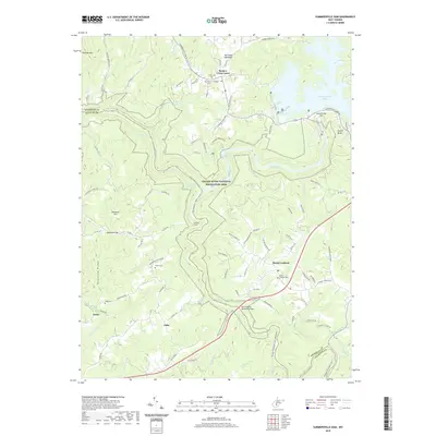
2019 Map of Summersville Dam
USGS Topo · Published 2019About this map
Summersville Lake dominates the northeastern corner of this West Virginia landscape, held back by the prominent Summersville Dam at the head of the Gauley River. The river's winding canyon through the Gauley River National Recreation Area is marked by a series of whitewater features including Iron Ring Rapids, Lost Paddle Rapids, and Pillow Rock Rapids. These names suggest a terrain defined by dramatic elevation changes where the Gauley and Meadow River carve through the plateau.
Find a feature on this map
97 named features on this map. Tap any name to fly to it.
Don’t see what you’re looking for? This feature index may not catch every label — zoom into the map to look around manually.
Map Details
Editions of this 2019 Summersville Dam Map
This is the sole edition of this map. No revisions or reprints were ever made.
Other maps of this area

1889 · Nicholas
USGS Topo · 1:125,000

1891 · Nicholas
USGS Topo · 1:125,000

1897 · Kanawha Falls
USGS Topo · 1:125,000

1900 · Kanawha Falls
USGS Topo · 1:125,000

1901 · Nicholas
USGS Topo · 1:125,000

1901 · Kanawha Falls
USGS Topo · 1:125,000

1908 · Clay
USGS Topo · 1:48,000

1908 · Fayetteville
USGS Topo · 1:48,000

1910 · Clay
USGS Topo · 1:62,500

1910 · Fayetteville
USGS Topo · 1:62,500