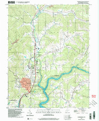
2023 Map of Summersville
USGS Topo · Published 2023About this map
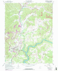
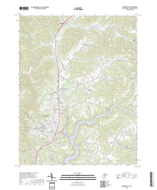
Summersville serves as the focal point of this Nicholas County study, centered on its civic heart at the Nicholas County Courthouse and the Nicholas County Magistrate Court. The landscape is defined by the deep winding path of the Gauley River, which feeds into the expanse of Summersville Lake to the south. The transition from town to rural highlands is marked by prominent terrain like Lonetree Mountain and Chapman Ridge, while smaller settlements such as Muddlety, Persinger, and Canvas are scattered along the creek valleys.
Find a feature on this map
125 named features on this map. Tap any name to fly to it.
Don’t see what you’re looking for? This feature index may not catch every label — zoom into the map to look around manually.
Map Details
Editions of this 2023 Summersville Map
This is the sole edition of this map. No revisions or reprints were ever made.
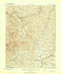
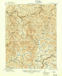
Historical Maps of Persinger Ford Through Time
5 maps found