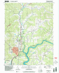
1996 Map of Summersville
USGS Topo · Published 2003About this map
Summersville and its surrounding hill country are defined by the convergence of the Gauley River and the expansive Summersville Lake during the mid-1990s. The town acts as a central hub, while the terrain to the north and east is dotted with small settlements like Hookersville, Muddlety, and Canvas. This topography highlights a landscape where resource extraction and recreation meet, shown through the presence of several mines and gas wells alongside the Summersville Lake State Wildlife Management Area. Local genealogy is well-represented through numerous country churches, including St Martins Ch, Jordan Chapel, and the Bennett Memorial Chapel, as well as the Glade Creek Sch. The winding paths of Muddlety Creek and Phillips Run illustrate the drainage patterns that shaped early settlement and local transport long before modern highway development changed the face of Nicholas County.
Find a feature on this map
51 named features on this map. Tap any name to fly to it.
Don’t see what you’re looking for? This feature index may not catch every label — zoom into the map to look around manually.
Map Details
Editions of this 1996 Summersville Map
This is the sole edition of this map. No revisions or reprints were ever made.
Other maps of this area

1889 · Nicholas
USGS Topo · 1:125,000

1891 · Nicholas
USGS Topo · 1:125,000

1901 · Nicholas
USGS Topo · 1:125,000

1913 · Summersville
USGS Topo · 1:48,000

1914 · Winona
USGS Topo · 1:48,000

1915 · Cowen
USGS Topo · 1:48,000
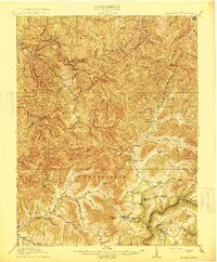
1915 · Summersville
USGS Topo · 1:62,500

1916 · Winona
USGS Topo · 1:62,500

1917 · Cowen
USGS Topo · 1:62,500

1918 · Richwood
USGS Topo · 1:62,500