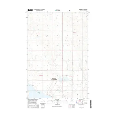
2015 Map of Summerville
USGS Topo · Published 2015About this map
The Grand River National Grassland dominates this Perkins County landscape, where the prairie meets significant water features in a predominantly rural setting. The Grand River flows through the southern portion of the quadrangle, feeding into the expansive Shadehill Reservoir, which creates a distinct shoreline featuring Ketterlings Point. This 2015 data reflects the modern management of these public lands, showing the intersection of managed grassland and the water resources that define the region's geography.
Find a feature on this map
22 named features on this map. Tap any name to fly to it.
Don’t see what you’re looking for? This feature index may not catch every label — zoom into the map to look around manually.
Map Details
Editions of this 2015 Summerville Map
This is the sole edition of this map. No revisions or reprints were ever made.
Other maps of this area

1954 · Lemmon
USGS Topo · 1:250,000

1957 · Lemmon
USGS Topo · 1:250,000

1974 · White Butte
USGS Topo · 1:24,000

1974 · Lemmon
USGS Topo · 1:24,000
1974 · Lemmon NE
USGS Topo · 1:24,000

1983 · Haynes SE
USGS Topo · 1:24,000
1983 · Lemmon Lake
USGS Topo · 1:24,000

1983 · Bison NE
USGS Topo · 1:24,000

1983 · Meadow NW
USGS Topo · 1:24,000
1983 · Meadow NE
USGS Topo · 1:24,000