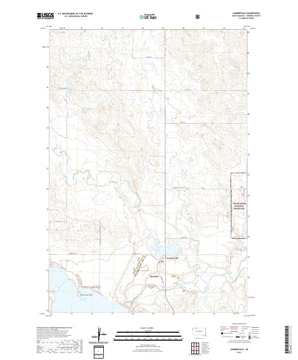
2021 Map of Summerville
USGS Topo · Published 2021About this map
Summerville and Shadehill sit at the intersection of a vast prairie landscape and the engineered hydrology of the northern plains. The map is dominated by the Shadehill Reservoir, which pools at the confluence where Flat Cr and the Grand River meet. This area serves as a primary recreational and ecological hub within the Grand River National Grassland, featuring specific shoreline landmarks like Ketterlings Point and the Swim Beach.
Find a feature on this map
26 named features on this map. Tap any name to fly to it.
Don’t see what you’re looking for? This feature index may not catch every label — zoom into the map to look around manually.
Map Details
Editions of this 2021 Summerville Map
This is the sole edition of this map. No revisions or reprints were ever made.
Other maps of this area

1954 · Lemmon
USGS Topo · 1:250,000

1957 · Lemmon
USGS Topo · 1:250,000

1974 · White Butte
USGS Topo · 1:24,000

1974 · Lemmon
USGS Topo · 1:24,000
1974 · Lemmon NE
USGS Topo · 1:24,000

1983 · Haynes SE
USGS Topo · 1:24,000
1983 · Lemmon Lake
USGS Topo · 1:24,000

1983 · Bison NE
USGS Topo · 1:24,000

1983 · Meadow NW
USGS Topo · 1:24,000
1983 · Meadow NE
USGS Topo · 1:24,000