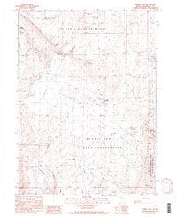
1990 Map of Summit Lake
USGS Topo · Published 1990About this map
Summit Lake Indian Reservation and the Sheldon National Wildlife Refuge define this northern Nevada landscape, where the waters of Summit Lake are fed by drainage from Mahogany Creek and Snow Creek. This 1990 provisional map documents a remote high-desert environment where historical human imprints intersect with conservation areas. In the eastern portion of the sheet, the Camp McGarry (Historical Site) marks a 19th-century military outpost, situated near the Summit Lake Cem.
Find a feature on this map
31 named features on this map. Tap any name to fly to it.
Don’t see what you’re looking for? This feature index may not catch every label — zoom into the map to look around manually.
Map Details
Editions of this 1990 Summit Lake Map
2 editions found
Other maps of this area

1886 · Disaster
USGS Topo · 1:250,000

1889 · Long Valley
USGS Topo · 1:250,000

1893 · Disaster
USGS Topo · 1:250,000

1954 · Vya
USGS Topo · 1:250,000

1958 · Vya
USGS Topo · 1:250,000

1962 · Vya
USGS Topo · 1:250,000

1965 · Idaho Canyon
USGS Topo · 1:62,500

1965 · Rock Spring Table
USGS Topo · 1:62,500

1972 · Soldier Meadow
USGS Topo · 1:24,000

1972 · Burnt Springs
USGS Topo · 1:24,000