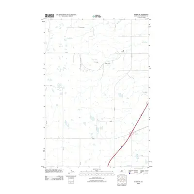
2012 Map of Summit NE
USGS Topo · Published 2012About this map
The glacial landscape of Roberts County is defined by a complex network of wetlands and coulees in this 2012 survey. Spring Grove and the nearby Old Ascension Cem serve as primary points of interest for genealogists and local historians tracking the early settlement patterns of the Old Agency District. The terrain is notably dissected by Big Spring Cr and Big Coulee Cr, which flow through the undulating plains toward the prominent depression of Big Coulee. This modern topographic study illustrates the persistence of rural infrastructure, from the small-scale Whipple Ranch Airport to the grid of Indian Routes and section roads. The southern edge of the quadrangle is marked by Mollie Lake, one of many prairie potholes that characterize the hydrology of this northeastern South Dakota region.
Find a feature on this map
24 named features on this map. Tap any name to fly to it.
Don’t see what you’re looking for? This feature index may not catch every label — zoom into the map to look around manually.
Map Details
Editions of this 2012 Summit NE Map
This is the sole edition of this map. No revisions or reprints were ever made.
Other maps of this area

1916 · Peever
USGS Topo · 1:62,500

1918 · Peever
USGS Topo · 1:62,500

1953 · Milbank
USGS Topo · 1:250,000

1958 · Milbank
USGS Topo · 1:250,000

1970 · Summit
USGS Topo · 1:24,000

1970 · Summit NE
USGS Topo · 1:24,000

1970 · Marvin
USGS Topo · 1:24,000

1970 · Wilmot NW
USGS Topo · 1:24,000

1970 · Enemy Swim Lake East
USGS Topo · 1:24,000

1970 · Ortley
USGS Topo · 1:24,000
Featured Places
- Old Agency District, SD
- Spring Grove, SD
- Enemy Swim District, SD
- Big Course District, SD
- Roberts County, SD