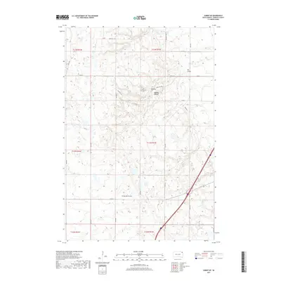
2017 Map of Summit NE
USGS Topo · Published 2017About this map
Coteau des Prairies defines the elevated landscape of this South Dakota region, where the high ground of the plateau meets the drainage of the Big Coulee. The small settlement of Spring Grove serves as a local focal point, surrounded by evidence of early community life in the Old Agency District. This area preserves distinct cultural sites such as the Old Ascension Cem and the nearby Ascension Presbyterian Cem, reflecting the spiritual and genealogical history of the Sisseton Wahpeton Oyate lands. The topography is intricately carved by Big Spring Cr and Big Coulee Cr, which draw from the Big Spring at the northern edge of the sheet. A network of rural routes, including Indian Rte 200 and Indian Rte 1100, connects these remote highlands, illustrating the modern management of tribal and public lands.
Find a feature on this map
32 named features on this map. Tap any name to fly to it.
Don’t see what you’re looking for? This feature index may not catch every label — zoom into the map to look around manually.
Map Details
Editions of this 2017 Summit NE Map
This is the sole edition of this map. No revisions or reprints were ever made.
Other maps of this area

1916 · Peever
USGS Topo · 1:62,500

1918 · Peever
USGS Topo · 1:62,500

1953 · Milbank
USGS Topo · 1:250,000

1958 · Milbank
USGS Topo · 1:250,000

1970 · Summit
USGS Topo · 1:24,000

1970 · Summit NE
USGS Topo · 1:24,000

1970 · Marvin
USGS Topo · 1:24,000

1970 · Wilmot NW
USGS Topo · 1:24,000

1970 · Enemy Swim Lake East
USGS Topo · 1:24,000

1970 · Ortley
USGS Topo · 1:24,000
Featured Places
- Old Agency District, SD
- Spring Grove, SD
- Enemy Swim District, SD
- Big Course District, SD
- Roberts County, SD